
Most visitors to New York City see Brooklyn as a brief detour — a walk across the bridge for a photo, maybe a coffee in DUMBO, then back to Manhattan. That is a shame. Brooklyn is the most populous borough in New York City, home to more than 2.7 million people, and it holds dozens of neighbourhoods that most tourists never reach. Each has its own character, its own food scene, and its own reasons to visit.
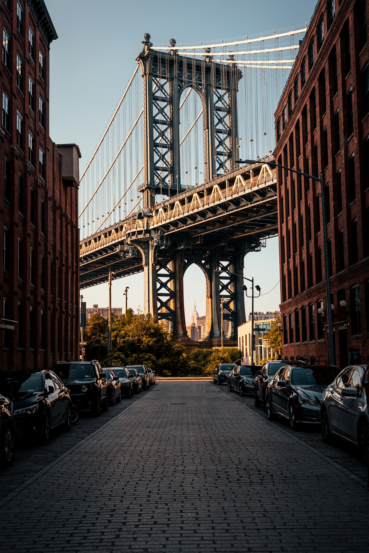
If you have already done the Brooklyn Bridge and Williamsburg and want to see what the borough actually looks like beyond the tourist circuit, these are the neighbourhoods worth your time.
Want more New York? Get our free weekly newsletter packed with hidden gems, local tips, and the stories visitors miss. Subscribe here — it’s free.
Bay Ridge
Bay Ridge sits at the south-western tip of Brooklyn, facing the Narrows and the water beyond. It is a long ride on the R train from Midtown — about 45 minutes — and that distance has kept most tourists away. That is exactly why it is worth the trip.
The neighbourhood has a strong Middle Eastern and Mediterranean food scene, built around Third and Fifth Avenues. You will find Lebanese bakeries, Turkish restaurants, and Greek diners that have been serving the local community for decades. The Shore Road Promenade runs along the waterfront and gives you clear views of the Verrazano-Narrows Bridge, the longest suspension bridge in the Western Hemisphere when it opened in 1964.
Bay Ridge is also a genuinely walkable neighbourhood with solid local shops, no tourist crowds, and a pace that feels entirely different from the busier parts of Brooklyn. The R train runs directly there from Midtown; alight at Bay Ridge Avenue or Bay Ridge-95th Street depending on which end of the commercial strip you want to explore.
Crown Heights
Crown Heights is one of the most culturally layered neighbourhoods in all of New York City. It is home to a large Caribbean community, a significant Orthodox Jewish community centred on Eastern Parkway, and a growing number of long-term residents who have lived here for generations. The neighbourhood has changed significantly over the past 15 years, but it retains a strong local identity that is hard to find in more gentrified parts of Brooklyn.
The Brooklyn Museum sits right on the border of Crown Heights and Prospect Heights. It is the second largest art museum in the United States and consistently undervisited compared to the Met. The collection covers ancient Egyptian art, American painting, and a strong programme of contemporary work. Admission is pay-what-you-wish on the first Saturday evening of each month.
Eastern Parkway itself — a broad, tree-lined boulevard designed by Frederick Law Olmsted — is worth a walk. Caribbean food along Utica Avenue is excellent and affordable. The West Indian Day Parade each September is one of the largest street festivals in North America, drawing more than a million people.
Take the 3 or 4 train to Crown Heights-Utica Avenue, or the 2 or 3 to Eastern Parkway-Brooklyn Museum.
Red Hook
Red Hook is cut off from the rest of Brooklyn by the Brooklyn-Queens Expressway and has no direct subway connection, which has preserved it from the rapid change that overtook Williamsburg and DUMBO. It is a waterfront neighbourhood built around a former industrial port, and much of that industrial character remains.
The IKEA in Red Hook, despite being an unusual tourist attraction, has a free water taxi from Pier 11 in Lower Manhattan during summer months. Many people use it as a cheap way to cross the harbour and explore the area. The waterfront gives you some of the best views of the Statue of Liberty and Governors Island available without paying for a ferry.
The Valentino Pier is a small park on the waterfront that is consistently ranked among the best view spots in New York City. The food truck cluster near the Red Hook Ball Fields on weekends is a long-running institution — a mix of Central and South American vendors who have been operating there since the 1970s. The pupusas, tacos, and Ecuadorian food on offer are genuinely excellent and inexpensive.
To get to Red Hook without a car, take the B61 bus from Court Street-Borough Hall subway station, or walk from the Smith-9th Streets F/G station, about 15 minutes on foot.
Want more New York? Get our free weekly newsletter packed with hidden gems, local tips, and the stories visitors miss. Subscribe here — it’s free.
Sunset Park
Sunset Park is one of the most ethnically diverse neighbourhoods in New York City, with large Chinese, Mexican, and Central American communities occupying different sections of the area. The eponymous park sits on a ridge and offers a panoramic view of the Manhattan skyline and New York Harbour that few visitors know about. On a clear day the view stretches from Lower Manhattan across to New Jersey.
Eighth Avenue through Sunset Park is Brooklyn’s main Chinatown — often considered more authentic and less crowded than the Manhattan Chinatown. The bakeries, seafood restaurants, and herbal medicine shops cater to local residents rather than tourists, and prices reflect that. Fifth Avenue through the southern section of the neighbourhood has excellent Mexican and Central American restaurants.
Industry City, a large converted warehouse complex on the waterfront, has added design studios, food halls, and independent retailers to the neighbourhood’s southern edge. It is a useful reference point and easy to find, though the commercial district along Eighth Avenue predates it by decades and is more representative of the neighbourhood.
The D, N, or R train to Sunset Park station, or the N or D to 59th Street, puts you within easy walking distance of both the park and the commercial strip.
Bushwick
Bushwick has one of the most concentrated collections of street art in the United States. The Bushwick Collective, an open-air street art project along Troutman Street and the surrounding blocks, has been building since 2011 and now covers several square blocks of warehouse walls with large-scale murals by artists from around the world. It is a legitimate open-air gallery, free to visit, and accessible without a guide.
Beyond the murals, Bushwick has developed a significant arts and nightlife scene built in and around former industrial spaces. This brings both positives — interesting galleries, music venues, and independent food spots — and the usual tensions that come with rapid neighbourhood change. The food options along Myrtle Avenue and the surrounding streets are varied and reasonably priced.
The L train to Jefferson Street or the M train to Knickerbocker Avenue are the main access points. The murals are most concentrated around Troutman Street, St Nicholas Avenue, and Wyckoff Avenue.
Greenpoint
Greenpoint is Brooklyn’s northernmost neighbourhood, sharing a border with Long Island City in Queens and sitting on the East River directly across from Midtown Manhattan. It has a strong Polish heritage — Polish bakeries, delis, and restaurants along Manhattan Avenue have been here for generations — alongside a more recent wave of artists and independent businesses.
The waterfront in Greenpoint has opened up considerably in recent years. Transmitter Park, a small but well-designed waterfront green space, offers direct views across the river to the Midtown skyline. The WNYC Transmitter Park area is quiet, particularly on weekday mornings, and feels nothing like the tourist-heavy waterfront in DUMBO.
The neighbourhood has a good independent bookshop (Word Brooklyn on Franklin Street), solid coffee, and a bakery scene that reflects its Polish roots. The G train runs through Greenpoint (Nassau Avenue station) and connects south through Brooklyn without passing through Manhattan — useful if you are moving between Brooklyn neighbourhoods rather than into the city.
Want more New York? Get our free weekly newsletter packed with hidden gems, local tips, and the stories visitors miss. Subscribe here — it’s free.
Getting Between Neighbourhoods
One practical note: these neighbourhoods are spread across a large borough, and most tourists underestimate Brooklyn’s size. It takes about 40 minutes to travel from Greenpoint in the north to Bay Ridge in the south by subway, with a change required. Planning two or three neighbourhoods per day is realistic; trying to cover all of them in a single visit is not.
The MTA subway map shows most of what you need, but Google Maps is more reliable for real-time travel between Brooklyn points. An OMNY card (the tap-to-pay system on all NYC transit) is the simplest way to pay; it also offers a fare cap that can reduce costs if you are moving around the borough extensively in a single day.
Why These Neighbourhoods Matter
The question of which Brooklyn neighbourhood deserves more visitor attention does not have a single answer. The honest response is that most of them do. The borough’s reputation in travel media tends to focus on a small cluster of places — Williamsburg, DUMBO, Brooklyn Heights — that are already well-visited, while the neighbourhoods where most Brooklyn residents actually live remain largely unknown to visitors.
The neighbourhoods above are not hidden. They are not secret. They are simply overlooked because the tourist circuit has not yet caught up with them. Most are served by the subway, most have good food options at reasonable prices, and none require specialist knowledge to navigate. They just require the decision to get on a train and travel a little further south, east, or north than the travel guides typically suggest.
That decision, consistently, is worth making.
