
The New York City subway guide that most visitors need is not the map on the station wall — it is a practical, honest primer on how the system actually works. The subway is the fastest, cheapest, and most exhilarating way to move through this city, connecting Manhattan to Brooklyn, Queens, the Bronx, and Staten Island in a network that never sleeps. Once you understand the basics, you will wonder how anyone gets around New York City any other way.
This guide covers everything a first-time visitor needs to know: how to pay, how to read the map, which lines to use, how to reach the airports, and the unwritten etiquette that New Yorkers take for granted. By the time you finish reading, the subway will feel less like a maze and more like the brilliant, slightly chaotic urban artery it truly is.
Why the Subway Is the Best Way to Get Around New York City
Taxis and rideshares are expensive, especially during peak hours when Manhattan traffic grinds to a halt. The subway, by contrast, runs 24 hours a day, seven days a week, and costs the same flat fare regardless of how far you travel. A single ride across the entire borough of Brooklyn costs exactly the same as a short hop from Times Square to Grand Central.
For tourists, the financial savings add up fast. A family of four using the subway for a week in New York City will spend a fraction of what they would on taxis. And unlike a cab stuck in Midtown traffic, the subway moves. It dips beneath the rivers, rattles through neighbourhoods that no tourist bus visits, and surfaces in places that make you feel like a genuine New Yorker.
If you are planning a three-day trip to New York City, the subway is the difference between seeing four attractions and seeing a dozen. Time spent above ground in traffic is time not spent exploring.
Understanding the New York City Subway System
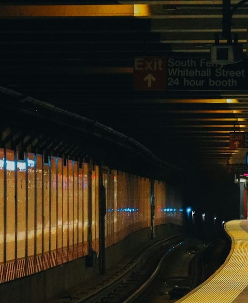
The NYC subway has 472 stations spread across 36 lines and more than 400 kilometres of track. It sounds overwhelming until you realise that most visitors only ever need a handful of those lines, and the system follows a logical geography once you understand its structure.
Lines, Letters, and Numbers
Subway lines are identified by letters or numbers. Number lines (1, 2, 3, 4, 5, 6, 7) tend to run north–south through Manhattan and into the outer boroughs. Letter lines (A, C, E, B, D, F, M, N, Q, R, W, J, Z, G, L) cover a wider range of routes. The colour of a line on the map tells you which trunk route it shares — the 1, 2, and 3 trains are all red because they share the same track in Manhattan before branching.
Express Trains vs Local Trains
This is the concept that trips up most first-time visitors. Express trains skip stops. Local trains stop everywhere. On the same track, the 2 and 3 trains run express (stopping only at major stations), while the 1 train runs local (stopping at every station). If you need a specific stop, check whether your train is express or local before boarding — riding express past your stop is a rite of passage, but not a pleasant one.
Look for the small circle or diamond beside a station name on the official MTA map. A filled circle means the station serves express trains; a hollow circle means local only.
How to Pay for the New York City Subway
The old MetroCard system is being phased out in favour of OMNY, a contactless payment system. In 2026, both systems still operate at most stations, but OMNY is the simpler and more convenient option for most visitors.
OMNY: Tap and Go
OMNY stands for One Metro New York. It accepts contactless bank cards (including Visa, Mastercard, and American Express), Apple Pay, Google Pay, and Samsung Pay. Simply tap your card or device at the turnstile reader. The current single-ride fare is $2.90 (as of 2026), deducted directly from your payment method.
OMNY also offers an automatic weekly fare cap. Once you have paid for 12 rides in a seven-day period, all further rides within that period are free. This is equivalent to an unlimited weekly pass, but with no upfront cost. For visitors staying a full week, this is an excellent deal.
MetroCard: The Older Option
MetroCards are available at vending machines inside every subway station. You can load a fixed dollar amount (pay-per-ride) or purchase a 7-day or 30-day unlimited card. The 7-day unlimited card is good value for visitors who plan to use the subway frequently. However, OMNY’s automatic fare cap now offers the same benefit without the need to queue at a vending machine.
Note that MetroCard machines occasionally malfunction or run out of paper for receipts. Having a contactless payment option as a backup is always wise.
Exploring New York City?
Get the inside guide — from hidden subway secrets to the neighbourhoods most visitors miss. Join 1,000+ New York lovers free →
How to Read the New York City Subway Map
The official MTA subway map is available free at any station booth and on the MTA website. The Google Maps and Apple Maps apps both include real-time subway information, which is far more useful when you are trying to navigate on the go.
Uptown and Downtown
In Manhattan, train directions are described as “uptown” (heading north towards the Bronx) or “downtown” (heading south towards Brooklyn). The platforms are usually separated — you board on the uptown side or the downtown side. Check the signs carefully before descending to the platform.
One common mistake: many stations in Manhattan have separate entrances for uptown and downtown trains. Entering through the wrong door means paying again to cross to the correct platform. Look for signs above street level before swiping.
Across the Boroughs
Beyond Manhattan, subway directions are described by the train’s final destination, displayed on signs at the platform and on the front of the train itself. “Trains to Coney Island” tells you the train is heading south through Brooklyn. “Trains to Jamaica” means you are heading east into Queens.
Exploring Brooklyn? Our guide to Brooklyn vs Manhattan for tourists covers which borough suits your travel style — and how the subway connects them.
The Best Subway Lines for Tourists in New York City
You do not need to learn all 36 lines. These are the routes that serve the most tourist-friendly destinations:
- 4, 5, 6 (green lines): Run the length of the East Side of Manhattan, serving Grand Central Terminal, the Metropolitan Museum of Art, and Yankee Stadium in the Bronx. The 4 and 5 are express; the 6 is local.
- A, C (blue lines): Serve the West Side of Manhattan, including Columbus Circle, the West Village, and Lower Manhattan. The A train reaches JFK Airport via the AirTrain connection at Howard Beach.
- N, Q, R, W (yellow lines): Serve Times Square, 34th Street, Union Square, and continue into Queens and Brooklyn.
- L (grey line): The quickest route from 14th Street in Manhattan to Williamsburg in Brooklyn — the creative heartland of the city. Runs frequently and reliably.
- 7 (purple line): Runs from Times Square through Queens, serving Jackson Heights and the Flushing food scene — one of the most culturally rich rides in the city.
- 2, 3 (red lines, express): Connect Midtown Manhattan to Harlem and onwards to Brooklyn, good for reaching Prospect Park and the Brooklyn Museum.
Getting to New York City Airports by Subway
All three major airports serving New York City are reachable by public transport, though each route has its quirks.
JFK Airport
Take the A train to Howard Beach–JFK Airport station, then board the AirTrain JFK to your terminal. The AirTrain costs $8.50 separately, paid at the AirTrain fare machines. Journey time from Midtown Manhattan: approximately 60–75 minutes depending on connections. This is far cheaper than a taxi or rideshare, which typically costs $60–80 or more.
LaGuardia Airport
LaGuardia has no direct subway link. The Q70 Select Bus Service (LaGuardia Link) connects the airport to the Jackson Heights–Roosevelt Avenue subway station in about 10 minutes. From there, trains take you into Manhattan in a total journey time of around 45–60 minutes from Midtown.
Newark Airport
Newark Liberty International Airport is served by NJ Transit trains from New York Penn Station. Take the subway to Penn Station (1, 2, 3, A, C, E trains), then board an NJ Transit train to Newark Airport station, followed by the AirTrain to your terminal. Journey time from Midtown: approximately 40–50 minutes. An NJ Transit zone ticket is required in addition to your subway fare.
Essential Subway Tips for Visitors
A few practical points that the MTA map does not include:
- Stand clear of the closing doors. This announcement is a plea, not a warning. New Yorkers who force their way through closing doors slow the whole system. Wait for the next train.
- Give up your seat. Priority seating near the doors is for elderly passengers, pregnant women, and people with disabilities. Giving up your seat anywhere is good form.
- Move to the centre of the carriage. Blocking the doorway because you are almost at your stop means everyone pushes past you. Step in fully and move towards the middle.
- Have your payment ready. Rummaging for your card at the turnstile during rush hour is universally unpopular.
- Use Google Maps or the MTA app. Real-time service alerts and route changes are updated continuously. The paper map cannot tell you the F train is running on the A line today.
- Travel off-peak when possible. Weekday rush hours (8–9am and 5–7pm) are the busiest. Mid-morning and early afternoon are significantly quieter.
Subway Safety for Tourists in New York City
The New York City subway is safe for tourists who use common sense. Keep your phone in your pocket when you are not using it. Stay aware of your surroundings at quieter stations late at night. Trust your instincts if a situation feels uncomfortable — move to a different carriage or exit to street level.
The busiest central stations — Times Square, Grand Central, Penn Station, Union Square — are always well-staffed and active. Late-night travel on the central Manhattan lines used by most visitors is generally straightforward for attentive travellers.
One genuine curiosity: the NYC subway’s extraordinary art collection is free to view on every single ride. From mosaic murals to sculpture installations, the system is an art museum you travel through without realising it.
What the Subway Unlocks for Free
A single fare from Midtown Manhattan puts you within walking distance of some of the city’s finest free experiences in New York City — the High Line, the Staten Island Ferry terminal, Prospect Park, and the remarkable cultural institutions spread across all five boroughs.
The subway is not just transport. It is part of the New York City experience — the place where the city’s extraordinary diversity is compressed into a single carriage. Musicians perform for tips (they auditioned for their spots). Office workers, tourists, schoolchildren, and artists share the same seats. There is nowhere else quite like a New York City subway car at any hour of the day.
Frequently Asked Questions: New York City Subway Guide
How much does the New York City subway cost per ride?
The single-ride fare on the New York City subway is $2.90 (as of 2026), payable via contactless card, phone, or MetroCard. This flat fare applies regardless of distance — a short hop from 42nd Street costs the same as a long ride to the far reaches of Brooklyn or Queens.
Is the New York City subway safe for tourists?
Yes — the New York City subway is safe for tourists who take basic precautions. Keep valuables out of sight, stay alert at quieter stations during late hours, and stick to well-lit carriages. The central Manhattan lines used by most visitors are busy around the clock and present no unusual risk for aware travellers.
How do I get from JFK Airport to Manhattan by subway?
Take the A train from any Manhattan station to Howard Beach–JFK Airport, then transfer to the AirTrain JFK (an additional $8.50 fare) to reach your terminal. The full journey takes approximately 60–75 minutes. Alternatively, take the E, J, or Z train to Jamaica station and connect to the AirTrain there for a potentially faster option from the east side of Manhattan.
What is the best subway app to use in New York City?
Google Maps and Apple Maps both offer accurate real-time subway directions and incorporate live service alerts. The official MTA app provides detailed status updates and planned service changes. For most visitors, Google Maps is the easiest option since no additional download is required and it works seamlessly with offline maps.
When is the best time to use the New York City subway to avoid crowds?
The New York City subway is busiest during weekday rush hours — 8–9am and 5–7pm. Mid-morning (10am–noon) and early afternoon (1–4pm) on weekdays are noticeably quieter. Weekends are generally calmer than weekdays, though major events at Madison Square Garden or Times Square can spike ridership at specific stations.
Join 1,000+ New York Lovers
Every weekday morning, get New York’s hidden gems, local secrets, and travel inspiration — the kind you won’t find in any guidebook.
Subscribe free — enter your email:
Love more? Join 64,000 Ireland lovers → · Join 43,000 Scotland lovers → · Join 30,000 Italy lovers →
Free forever · Unsubscribe anytime
Ready to explore New York City?
Check our guides to essential New York City travel tips and everything first-time visitors need to know.
Discover More of New York City
From hidden subway art to the boroughs most visitors never explore — your New York City adventure starts here.
Subscribe Free