
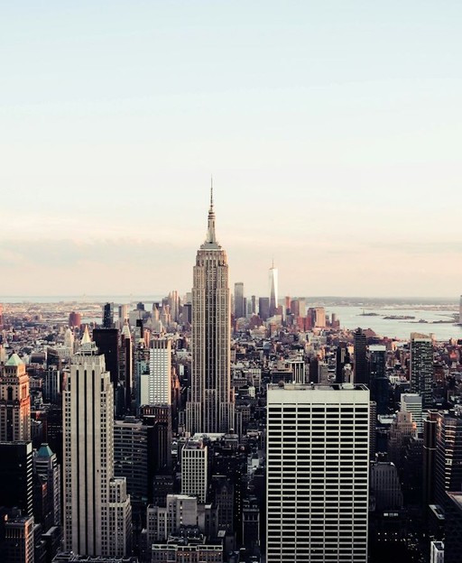
Getting around New York City is one of the great adventures of any visit. The city is vast, loud, and endlessly alive — and once you crack the code of its transport network, you unlock all of it. Whether you’re crossing Central Park on foot, rattling beneath Manhattan on the subway, or catching a ferry across New York Harbour, moving through NYC is an experience in itself.
This guide covers every way to get around New York City — from the iconic subway system to yellow cabs, buses, the Staten Island Ferry, cycling, and walking. You don’t need a car. You don’t need a degree in urban planning. You just need a little know-how, and this guide gives you all of it.
Getting Around New York City: Understanding Your Options
New York City’s five boroughs — Manhattan, Brooklyn, Queens, The Bronx, and Staten Island — each have their own character, and getting between them is surprisingly simple. The city’s public transport system is extensive. Most visitors rely on the subway, but buses, ferries, taxis, and rideshares all play a role in making the city navigable.
The key is knowing which option suits your situation. Late at night in Brooklyn? A cab or rideshare might suit best. Crossing from Midtown Manhattan to the Upper West Side? The subway wins every time. Heading to Staten Island for a morning? The ferry is your best friend — and it’s free.
The New York City Subway
The subway is the backbone of getting around New York City. It runs 24 hours a day, seven days a week, which is almost unique among world-class metro systems. Once you understand the basics, you’ll use it constantly.
How the Subway System Works
The subway uses numbered and lettered lines. Local trains stop at every station. Express trains skip certain stops and move faster on longer journeys. Lines are colour-coded on the map and grouped by corridor. The red 1, 2, and 3 trains all run along the West Side of Manhattan, but the 2 and 3 are express services.
Get the MTA’s official map from any station booth, or download it to your phone before you arrive. The MYmta app and Google Maps both give real-time service updates and step-by-step directions. Mobile signal can be patchy underground on older lines, so checking your route before you descend is wise.
Paying for the Subway
New York’s subway uses the OMNY contactless payment system. Tap your contactless debit or credit card, or your phone’s digital wallet, at the turnstile. One fare covers any single journey, with unlimited free transfers within two hours.
You can also buy a MetroCard — the traditional swipe card — from machines in every station. MetroCards come in pay-per-ride or unlimited weekly formats. The weekly unlimited card is excellent value if you plan to use the subway more than a couple of times per day. For a full breakdown of fares and strategies, see our complete New York City subway guide for tourists.
Subway Tips for First-Time Visitors
Stand clear of the closing doors — the announcements are serious. Move into the centre of the carriage to let people board at busy stations. Late-night trains can be infrequent, so check the schedule before heading out after midnight. Avoid rush hour on the most crowded lines — particularly the 4, 5, and 6 through Midtown — if you’re carrying luggage or travelling with children.
New York City Buses
Buses get unfairly overlooked by visitors. They cover streets the subway misses, particularly crosstown routes in Manhattan and neighbourhood routes across Queens and The Bronx. If you need to travel east to west across Midtown without walking, a crosstown bus is your answer.
How to Use NYC Buses
Tap your contactless card or OMNY device at the bus reader when you board. If paying with cash, use exact change — drivers don’t make change. Select Bus Service routes require you to pay at a machine on the pavement before boarding, then show proof of payment if asked on board.
Buses are slower than the subway in traffic but let you see the city at street level. The M15 running the length of First and Second Avenues is a fantastic sightseeing route. Routes connecting Brooklyn to Midtown Manhattan are popular with commuters but also useful for visitors staying in Williamsburg or Park Slope.
Express Buses to the Outer Boroughs
Express buses connect the outer boroughs to Manhattan and cost more than a standard fare. They’re aimed at commuters, but visitors staying in Staten Island, south Brooklyn, or eastern Queens might find them useful. Comfortable seats and less standing room make them a pleasant option for longer journeys.
Taxis and Rideshares in NYC
The yellow taxi cab is one of New York’s most recognisable icons. You’ll find them everywhere in Manhattan. Hail one by standing at the kerb and raising your hand when a cab with its roof light on passes — a lit roof light means the driver is available. Payment by card is accepted in virtually every cab.
Yellow Cabs, Green Cabs, and Rideshares
Yellow medallion cabs operate throughout Manhattan and can pick up passengers anywhere in the city. Green Boro cabs — officially called Street Hail Liveries — operate in the outer boroughs and upper Manhattan. They cannot be hailed south of 110th Street on the East Side or 96th Street on the West Side of Manhattan.
Rideshare apps — Uber, Lyft, and the New York-specific Via — work well across all five boroughs. They’re often more convenient for outer borough destinations where yellow cabs can be scarce. Surge pricing during peak hours can make rideshares expensive, so checking the fare estimate before booking is always worthwhile.
Tipping Etiquette in NYC Cabs
Tipping taxi drivers and rideshare drivers is standard practice in New York. Fifteen to twenty per cent is customary. The payment screens in yellow cabs offer pre-set options — tapping one is the easiest approach. It’s polite to round up even on short trips.
The Staten Island Ferry and NYC Ferry
The Staten Island Ferry is one of the finest free experiences in all of New York. It runs between Whitehall Terminal in Lower Manhattan and St George Terminal on Staten Island, 24 hours a day, every day of the year. The crossing takes about 25 minutes each way.
The views of the Manhattan skyline from the upper decks are spectacular, especially in the golden hour before sunset. You pass close to the Statue of Liberty and Governors Island. No reservation, no ticket, no cost — just walk on. For visitors wanting a brilliant afternoon experience that costs nothing, the round trip is hard to beat. Our full guide to the Staten Island Ferry covers everything you need to know.
NYC Ferry: The Paid Waterway Network
Separate from the Staten Island Ferry, the NYC Ferry service connects waterfront neighbourhoods across the city. Routes run from Astoria in Queens to Wall Street, from DUMBO in Brooklyn to Midtown, and from the Rockaways to Lower Manhattan, among others.
The NYC Ferry costs the same as a subway fare and accepts OMNY payment. It offers a completely different perspective on the city. The East River route connecting Brooklyn Bridge Park, DUMBO, and Midtown is particularly scenic and makes for a memorable journey between boroughs.
Walking Around New York City
Walking is often the best way to get around New York City. Manhattan’s street grid is famously logical — numbered streets run east to west, avenues run north to south. Once you grasp the layout, navigation becomes intuitive. Most numbered streets are one-way, alternating direction as you move uptown.
The Most Walkable Neighbourhoods in NYC
Manhattan is the most walkable borough. SoHo’s cast-iron architecture and boutique-lined streets, the West Village’s winding lanes and brownstone stoops, the High Line elevated park stretching through Chelsea, and the Lower East Side’s layers of immigrant history all reveal themselves best on foot.
In Brooklyn, DUMBO and Brooklyn Heights are supremely walkable, with some of the best skyline views in the city. Williamsburg’s main drag on Bedford Avenue is endlessly interesting on foot. In Queens, Flushing’s streets pack extraordinary cultural variety into a small area. For neighbourhood-by-neighbourhood guidance, our guide to the best neighbourhoods in NYC for tourists has everything you need.
How Far Can You Walk in NYC?
Manhattan is roughly 13 miles long and about 2 miles wide at its broadest point. Walking from Times Square to the Battery at the southern tip takes around 90 minutes at a comfortable pace. Most visitors cover several miles per day without realising it — good walking shoes are essential packing for any New York trip.
The blocks in Manhattan differ in length. Avenue blocks running east to west are much longer than street blocks running north to south. A useful rule of thumb: 20 street blocks equal roughly one mile. Plan your walks with this in mind, especially if you’re heading across multiple avenues.
Cycling in New York City
New York has invested heavily in cycling infrastructure over the past decade. Dedicated lanes now cover major routes in Manhattan, Brooklyn, and Queens. The city is genuinely bike-friendly in a way that surprises many first-time visitors.
Citi Bike: New York’s Bike Share Scheme
Citi Bike is New York’s bike-share programme. Docking stations appear throughout Manhattan, Brooklyn, Queens, and The Bronx. You can hire a standard pedal bike or an electric bike. Unlock using the Citi Bike app or your contactless payment card at any docking station.
A single 30-minute ride is available for a small fee. Day passes offer better value for visitors planning multiple trips. Electric bikes handle the hills of Brooklyn with ease and are popular for longer cross-borough rides. Return the bike to any available dock when you’re done — no need to return it to the original station.
Best Cycling Routes for Visitors
The loop around Central Park is the most famous cycling route in New York, at just under seven miles. It’s flat, scenic, and largely car-free during certain hours. The Hudson River Greenway runs along the western edge of Manhattan for over eleven miles — paved, protected from traffic, and with views across to New Jersey.
Cycling across the Brooklyn Bridge is on many visitors’ lists. The cycle lane sits above the road deck and the views are magnificent, though it gets crowded at midday. Cross into Brooklyn and continue into DUMBO or Brooklyn Heights for a satisfying half-day trip by bike.
Getting Between the Five Boroughs
Moving between Manhattan, Brooklyn, Queens, The Bronx, and Staten Island is simpler than it looks on a map. The subway connects them all except Staten Island, which has its own separate Staten Island Railway. Bridges and tunnels are served by buses, cabs, and rideshares.
Manhattan to Brooklyn
The subway is the fastest and most frequent option. The A, C, and F trains all cross into Brooklyn in under ten minutes from Midtown. The 2 and 3 trains serve central Brooklyn including Park Slope and Flatbush. Walking or cycling the Brooklyn Bridge takes around 30 minutes and is an experience in its own right.
Brooklyn has a huge amount to offer visitors. From the boutiques of Williamsburg and the food scene of Park Slope to the history of Coney Island and the views from Brooklyn Heights, it deserves at least a full day. Our guide to Brooklyn for tourists covers every neighbourhood in detail.
Manhattan to Queens and The Bronx
Queens is easy to reach by subway. The 7 train — sometimes called the International Express because of the cultural diversity along its route — runs from Times Square through Long Island City, Woodside, Jackson Heights, and Flushing. Queens is New York’s most diverse borough. Flushing is a major hub for Asian cuisine. Astoria carries a strong Greek heritage and excellent food. Getting out to Queens for a meal is one of the best decisions any visitor can make.
The 4, 5, and 6 trains run north from Manhattan into The Bronx in around 20 to 30 minutes. The Bronx is home to the New York Botanical Garden, Yankee Stadium, Arthur Avenue’s Italian-American community, and the birthplace of hip-hop. Many visitors skip The Bronx entirely, which is a genuine loss — it’s a borough with richness and authenticity that Midtown Manhattan cannot match.
Getting to and from NYC Airports
New York is served by three major airports: John F Kennedy International in Queens, LaGuardia in Queens, and Newark Liberty International in New Jersey. Getting into the city from each is slightly different.
From JFK Airport
The AirTrain connects JFK’s terminals to the subway. Take it to Jamaica Station and board the E, J, or Z subway to Manhattan, or take it to Howard Beach and board the A train. The full journey to Midtown takes around an hour. A yellow cab from JFK to Manhattan uses a flat rate — check the current figure on the NYC Taxi and Limousine Commission website. Rideshares from JFK are convenient but can be slow on the Van Wyck Expressway.
From LaGuardia and Newark Airports
LaGuardia has no direct rail connection to Manhattan. The M60 bus connects to several subway lines, but journey times can be slow in traffic. Taxis and rideshares are the most popular option. From Newark, the AirTrain connects to NJ Transit trains at Newark Liberty Airport Station, with services to New York Penn Station in Midtown taking around 30 minutes — often the quickest and most reliable option from New Jersey.
Practical Tips for Getting Around New York City
Download the Right Apps Before You Arrive
Before you arrive, download Google Maps or Citymapper for transit directions, the MYmta app for subway and bus information, the Citi Bike app if you plan to cycle, and Uber or Lyft for rideshares. Having these ready means you’re never scrambling for information mid-journey.
Avoid Rush Hour When You Can
New York’s rush hour runs roughly 7:30 to 9:30 in the morning and 4:30 to 7:00 in the evening on weekdays. The subway during these windows is intensely crowded on popular lines. If your schedule is flexible, shifting museum visits or borough excursions to mid-morning avoids the worst of it and makes the whole experience more pleasant.
Accessibility on New York’s Transport Network
Not all subway stations have lifts, and accessibility in the older parts of the network is limited. The MTA’s accessibility map — available on its website and in the MYmta app — shows which stations have step-free access. All NYC buses are fully accessible with ramps and designated spaces. The NYC Ferry and Staten Island Ferry are both fully accessible. If accessibility is a priority, planning your route around accessible stations in advance saves a lot of difficulty on the day.
Frequently Asked Questions About Getting Around New York City
What is the cheapest way to get around New York City?
The subway and buses are by far the cheapest options. A single fare covers unlimited transfers within two hours. The Staten Island Ferry is completely free. Walking costs nothing and is the best way to explore Manhattan’s most interesting areas. If you plan to use public transport heavily, a weekly unlimited MetroCard or OMNY weekly cap offers the best value for your budget.
Is the New York City subway safe for tourists?
Yes, for the vast majority of visitors the subway is perfectly safe. Millions of people use it every single day without incident. Common-sense precautions apply — keep valuables out of sight in crowded spaces, stay aware of your surroundings, and choose busier carriages late at night. The 24-hour operation is a genuine advantage over metro systems that shut overnight.
How do I get from Manhattan to Brooklyn without the subway?
You have several good options. Walking or cycling the Brooklyn Bridge takes 25 to 35 minutes and is a memorable experience. The NYC Ferry runs between Midtown Manhattan and DUMBO or Brooklyn Bridge Park. Rideshare apps and yellow cabs cross via the bridges. Each route offers different views and a different experience of the city.
Where is the best place to stay to make getting around easy?
Midtown Manhattan is the most convenient base for first-time visitors — central, well-served by every major subway line, and close to the main attractions. The Upper West Side and Upper East Side are quieter but extremely well-connected. In Brooklyn, Williamsburg and Brooklyn Heights offer good subway links and a more local atmosphere. Our full guide to where to stay in New York City breaks down every neighbourhood option in detail.
Join 1,000+ New York Lovers
Every week, get New York’s hidden gems, local secrets, and travel inspiration — the kind you won’t find in any guidebook.
Subscribe free — enter your email:
Love more? Join 64,000 Ireland lovers → · Join 43,000 Scotland lovers → · Join 30,000 Italy lovers →
Free forever · One email per week · Unsubscribe anytime